Miyiwts Park (Waterfront Landing)
Join us for the opening of Miyíw̓ts Park
Project Overview
Protecting and Restoring the Shoreline
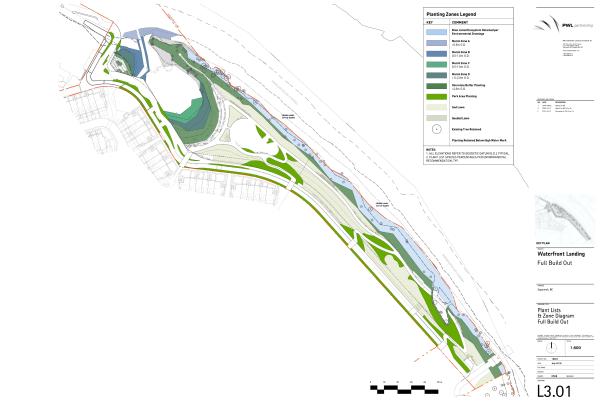
The shoreline adjacent to Waterfront Park provides a rich marine and intertidal habitat that supports many species of birds, fish and other wildlife. A primary goal of the park design is to restore and enrich this environment using Green Shores principles as much as possible (note: a portion of the shoreline area is Crown land, outside the park property). Because of site contamination from previous industrial use, some of the soil and vegetation have been removed and replaced with new soil and replanted with a diverse mix of native vegetation (trees, shrubs, grasses). Due to poor health of many trees adjacent to the shoreline, a number require removal prior to park development. An environmental Development Permit (DP 499) was issued by the District in April 2021 to guide the restoration of the shoreline and lagoon area, featuring extensive native plantings, removal of invasive species and shoreline fencing to protect the restored areas.
As of September 2023, the developer has successfully completed remedial activities including the treatment of contaminated soils and the removal of abandoned boats, piles, and barges from the Mamquam Blind Channel and has removed and replaced most of the contaminated soil and vegetation with new soil and a diverse mix of native vegetation (trees, shrubs, grasses).
Park Design
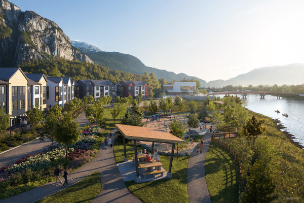
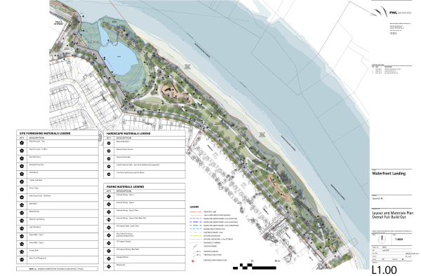
The rendering and conceptual park plan for Waterfront Park is shown below. Some minor changes to the plans are currently being completed to reduce the extent of paved walkways in the upper park area. Click the images below to view full size.
Timing of Park Construction
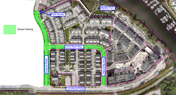
The first phase of the park is now open as of September 2023. Access to the park is located at the intersection of Capstan Drive and Helm Way. Parking is available to the public along Channel Road and Coho Rock Way. Future access to the park will include the Mamquam Blind Channel Pedestrian Bridge, currently awaiting final project approvals prior to construction.
Initial work began in 2021/2022 which included the removal of designated vegetation, construction of a new retaining wall adjacent to the lagoon, and placement of new structural fill material in the park. Construction for phase two is expected to take place in Fall/Winter 2023.
Project Updates
Update, September 2024:
The community is invited to attend the official opening on Monday, October 7 at 11 a.m. Miyíw̓ts Park is named after the Sḵwx̱wú7mesh sníchim (Squamish) word for riverbank, the park reflects the channel of the Squamish River that once ended where the park is located.
Update, October 23, 2023:
Please be advised that piling has begun at SEAandSKY, south of the North Park. In-water piling is set to complete by the end of January 2024, while out of water foreshore construction will complete spring 2024. Work will comply with the District of Squamish's Noise Regulation Bylaw.
Update, September 2023:
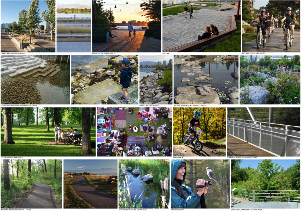
The first phase of the new District-owned community park has been completed. The park offers an expansive natural landscape, complete with ample greenspace, walking and cycling paths, a children's playground area and scenic lookout points. The balance of the park, to be completed by Fall 2024, will include a pump track, basketball court, and additional green spaces.
Further Information
- Detailed Bio-Inventory Waterfront Landing North Park Revision 4, March 26, 2021, prepared by Keystone Environmental
- Greenshores Principles Waterfront Landing North Park, February 15, 2019, prepared by Keystone Environmental
- Arboricultural Inventory and Report, February 17, 2021, prepared by Diamond Head Consulting
- Invasive Species Management Plan, March 24, 2021, prepared by Keystone Environmental
Questions
If you have any questions, please contact the Planning Department at planning@squamish.ca or call 604.815.5017.

