Squamish River Valley Strategic Recreation Management Plan survey launched
The Squamish River Valley has grown in popularity as an outdoor recreation and camping destination, with tens of thousands of visitors annually. This growth has resulted in increased environmental impacts, human-wildlife conflicts, public safety concerns and impacts to spiritually and culturally important recreation sites.
The Ministry of Forests, Lands, Natural Resource Operations and Rural Development (FLNRORD) is moving forward with the preparation of a Strategic Recreation Management Plan for the Squamish River Valley and is looking to engage Valley visitors and recreation users on important issues, ideas and strategies to improve the quality of recreation and the management of its impacts.
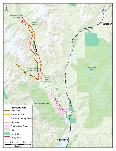
The Plan study area is located between 0 KM on the Squamish River Forest Service Road and approximately 30 KM on the Forest Service Road at the confluence of the Elaho and Squamish Rivers as indicated in the map below. The Plan will be developed in collaboration with the Squamish Nation, local and regional governments, recreational users and other stakeholders.
The community is invited to participate in the planning process by completing a short survey here. The survey will be open through March 31.
View the Squamish River Valley Recreation Management Plan Interactive Map here.
March 6, 2019